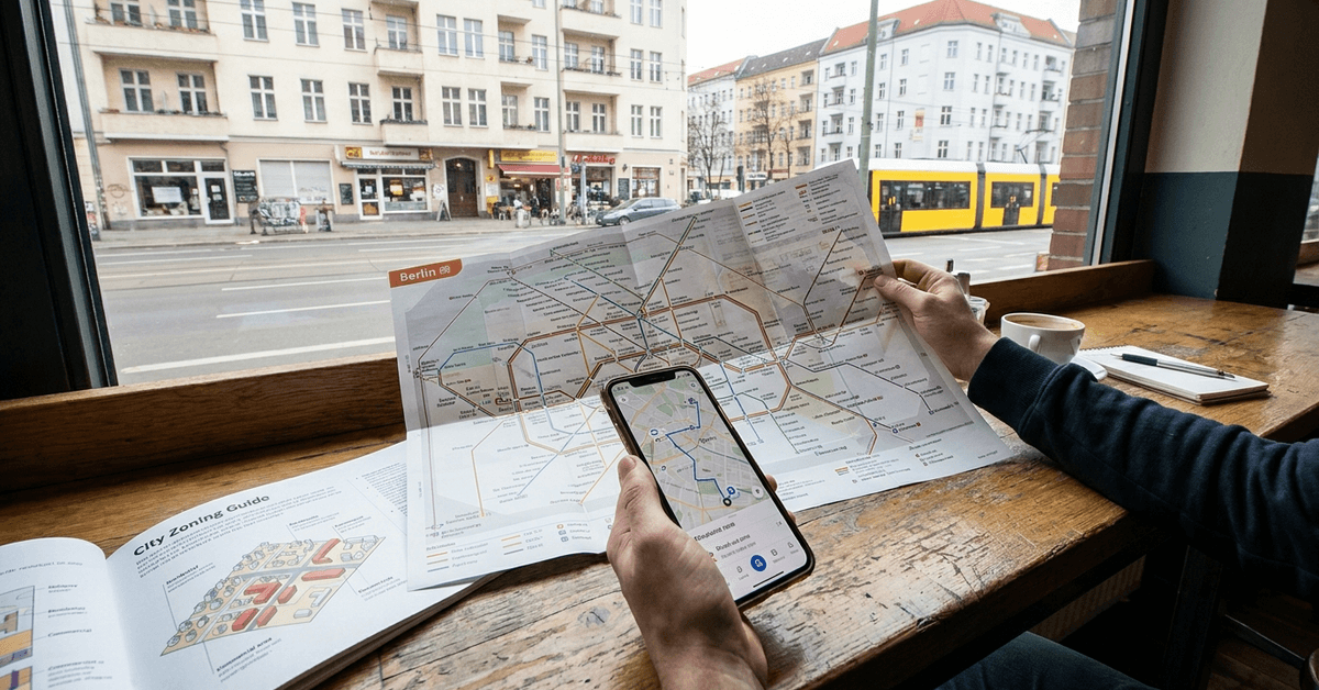
Finding your way through a city for the first time can feel overwhelming. City zoning and public transport maps may look confusing at a glance. Yet, mastering these tools quickly helps you settle into city life, commute easily, and explore new districts with confidence.
This guide is for anyone just starting in a new city, planning day trips, or aiming to enjoy urban living more efficiently. Understanding zoning and transit maps gives you both flexibility and independence. The benefit? Less time lost and more confidence exploring.
What Is City Zoning?
City zoning organizes a city into defined areas or “zones.” Each zone has a specific purpose: residential, commercial, industrial, or mixed-use. Zoning rules can influence where people live, work, and play.
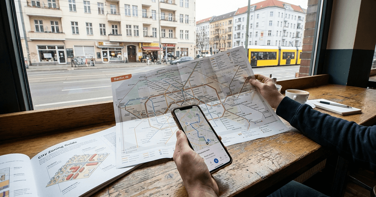
Zoning shapes traffic flow, noise levels, and even green space locations. Perhaps you have noticed different neighborhoods feel distinct. Zoning usually explains why.
Common Zoning Categories
- Residential: Homes, apartments, schools, parks.
- Commercial: Shops, offices, restaurants, entertainment venues.
- Industrial: Factories, warehouses, major infrastructure.
- Mixed-use: A combination—think shops with apartments above.
Zoning laws vary by city. For example, New York divides neighborhoods into comprehensive use-codes, while Berlin often blends residential and small business space.
How City Zoning Affects Your Daily Life
Zoning affects more than city structure. It shapes how you move through the city and the experiences available.
- Living in a residential zone often means quieter streets.
- Proximity to commercial zones means better access to shops and transport.
- Living near a mixed-use area can shorten commutes and increase amenities.
For urban day trips, knowing the boundaries of industrial zones can also help avoid low-interest areas.
Basics of Public Transport Maps
A public transport map is designed to simplify city movement. These maps detail train, tram, metro, and sometimes bus routes. The most familiar example is the London Underground Map.
Most major cities present simplified, color-coded diagrams instead of exact geography. This aids quick decision-making, but it can be confusing at first.
Symbols and Colors You Might See
- Line colors: Each transit line has its own color, e.g., Paris Metro’s pink line.
- Icons: Circles for stations, larger circles or stars for major interchanges.
- Transfer points: Spots where two or more lines intersect.
How to Read a Public Transport Map Step by Step
Adapting to public transport maps is a key urban survival skill. Here is a stepwise approach:
- Find your current location and intended destination. Sometimes apps like Google Maps can do this for you.
- Identify the nearest entry station. Many maps list key landmarks or neighborhoods adjacent to stations.
- Trace the line your journey will follow. Note color/path changes.
- Check if your route requires transfers. If yes, look for marked transfer points or central nodes.
- Estimate journey time. Most transit maps indicate the average time between key hubs.
Examples: Zoning and Mapping in Real Cities
New York City
NYC’s zoning map divides Manhattan and boroughs into dense grids. The MTA Subway Map shows zones visually, highlighting express vs. local stops.
Berlin
Berlin uses Zones A, B, and C for tickets. The BVG map overlays train, tram, and bus lines on these zones. Practically, crossing into C requires a special ticket.
Tokyo
Tokyo combines zoning for living/business and fare zones for transport. The Tokyo Metro map’s colored lines help users quickly spot connections, though English signage is sometimes limited.
Practical Apps and Digital Tools
- Citymapper: Integrates zoning and transport info for dozens of cities worldwide.
- Google Maps: Live transit updates and step-by-step route guidance.
- Moovit: Combines transit data with accessibility features.
- Official city apps: For example, RATP for Paris or BVG Fahrinfo for Berlin.
Strategies for Beginner Map Users
- Start with a high-level overview. Skim the map before diving into route details.
- Zoom in on your local neighborhood’s stops or lines first.
- Keep a printed map when mobile battery is low. Most tourist offices provide them.
- Update your chosen app before heading out—service variations or works can affect lines.
- Ask a local or transport staff if you feel stuck. Many are happy to help.
Common Hurdles and How to Overcome Them
Overlapping Lines
Cities like London and Tokyo often stack multiple lines. Tracing the right color and name is crucial. Squint once or twice; it is normal the first few times.
Hidden Stations
On some maps, smaller stations can blend in. It may be necessary to double-check with an app or the station signage. Familiarity comes with practice.
Ticketing zones confusion
Fare systems may not correspond exactly to administrative zones. Double-check what zones your ticket covers, especially for airports or city edges.
Tips for Using Maps for Day Trips or Leisure
- Map out transfers near major attractions. For example, Rome’s Colosseo Metro station serves as the main gateway to the Colosseum.
- Plan trips during off-peak hours for less crowding.
- Use apps to compare walking and transport times. Sometimes a 10-minute walk beats two transfers.
- If venturing beyond center-city, research if special transportation passes exist for tourists or day visitors.
Practical Insights for City Living
Living efficiently in a major city often depends on thoughtful housing choices, an understanding of public transportation, and a few simple digital habits. Small adjustments can save time, reduce daily stress, and make urban routines more manageable.
Prioritize Access to Main Transit Lines
Consider housing near a major train, metro, or bus line, even when the rent is slightly higher. A shorter and more reliable commute may justify the added cost by giving you more time for rest, family, exercise, or personal activities.
Before choosing a home, test the route during normal commuting hours. Check the walking distance to the station, the number of transfers required, and the availability of backup routes.
Understand Rush Hour Patterns
Learn when your local transportation system becomes busiest. In cities such as Paris or Madrid, popular lines may fill quickly between approximately 7:30 a.m. and 9:30 a.m.
Leaving slightly earlier or later can make the journey more comfortable. Transit apps can also help you compare alternative lines when delays or crowding occur.
Save Frequently Used Routes
Store your home, workplace, grocery store, pharmacy, and favorite destinations in your preferred navigation app. Saving regular routes prevents repeated searches and makes it easier to check travel times, delays, and nearby alternatives before leaving.
Conclusion
Learning to decode city zoning and public transport maps gives you practical freedom. It unlocks neighborhoods, shortens journeys, and takes away much of the stress that comes with city life.
While it may feel awkward at first, repetition builds skill and confidence. For anyone new to a city or hoping to maximize their experience, understanding these urban tools is not just helpful.
It is transformative. Every local was a beginner once—soon enough, you will navigate like one, too.